Restren:Greenland 1, Harbour of Ilulissat.jpg
Myns an ragwel ma: 800 × 545 piksel. Klerderyow erel: 320 × 218 piksel | 640 × 436 piksel | 1,024 × 698 piksel | 1,424 × 970 piksel.
Restren wreydhek (1,424 × 970 piksel, myns an restren: 583 KB, eghen MIME: image/jpeg)
| Restren dhyworth Wikimedia Commons yw hebma. Yma diskwedhys a-woles derivadow dhyworth y folen deskrifans ena. | Mos dhe folen an restren war Wikimedia Commons |
Berrskrif
| Deskrifans |
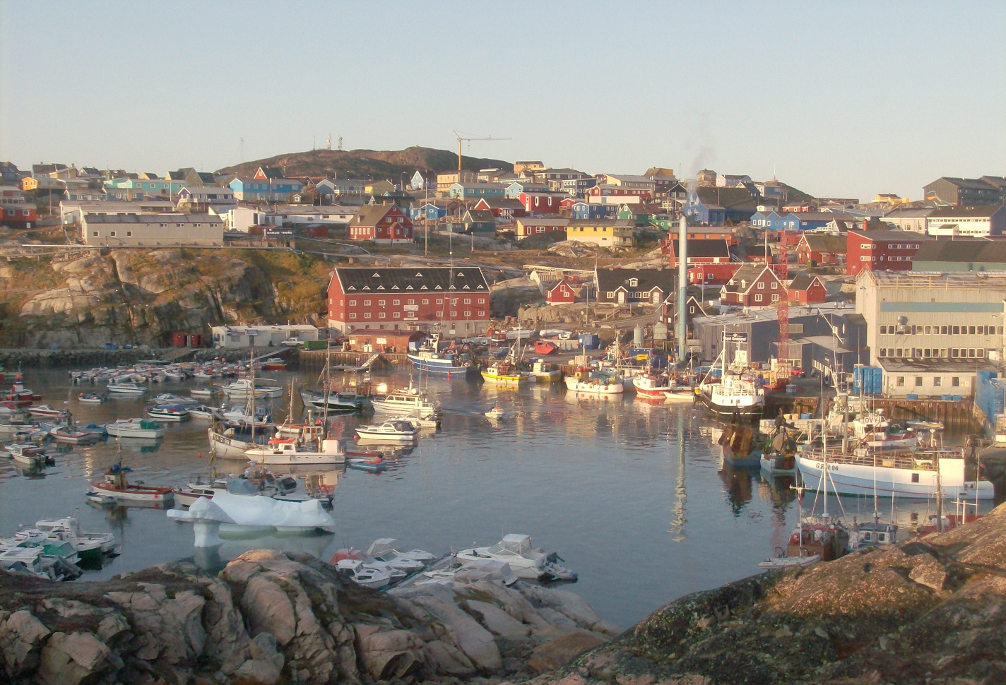
English: The harbour of Ilulissat, Greenland, at the end of the summer. |
| Dedhyans | |
| Pennfenten | Ober honan |
| Awtour | Vincent van Zeijst |
•
| Camera location | | View this and other nearby images on: OpenStreetMap |
|---|
Leshyans
I, the copyright holder of this work, hereby publish it under the following license:
This file is licensed under the Creative Commons Attribution 3.0 Unported license.
- Yma'n gwir dhywgh:
- a ranna – a dhasskrifa, lesranna ha treuskorra an ober
- a gemyska – a aswiwa an ober
- Yn-dann an ragselyow a syw:
- askrifans – Res yw dhywgh ri askrifans gwiw, provia kevren dhe'n lecyans, ha meneges mar peu chanjyow gwrys. Hwi a yll gul hemma yn fordh resonus a vynnowgh, mes ny yllir y wul yn fordh a broffo synser an lecyans dh'agas skoodhya po agas devnydh.
Istori an restren
Klyckyewgh war dhedhyans/eur rag gweles an folen dell o an termyn na.
| Dedhyans/Eur | Skeusennik | Mynsow | Devnydhyer | Kampol | |
|---|---|---|---|---|---|
| a-lemmyn | 18:49, 21 Est 2010 | | 1,424 × 970 (583 KB) | Loranchet | {{Information |Description={{en|1=The harbour of Ilulissat, Greenland, at the end of the summer.}} |Source=Own work |Author=Vincent van Zeijst |Date=10 September 2008 |Permission= |other_versions= }} •{{location|69|13|18.43|N|51|5|20.25|W|region:GL_head |
Devnydh an restren
Yma an folen a syw owth usya an restren ma:
Devnydh ollvysel an restren
Yma an wikis erel a syw ow tevnydhya an restren ma:
- Devnydh war ar.wikipedia.org
- Devnydh war arz.wikipedia.org
- Devnydh war ast.wikipedia.org
- Devnydh war bat-smg.wikipedia.org
- Devnydh war be.wikipedia.org
- Devnydh war ca.wikipedia.org
- Devnydh war ceb.wikipedia.org
- Devnydh war cs.wikipedia.org
- Devnydh war de.wikipedia.org
- Devnydh war de.wikivoyage.org
- Devnydh war el.wikipedia.org
- Devnydh war el.wikivoyage.org
- Devnydh war en.wikivoyage.org
- Devnydh war es.wikipedia.org
- Devnydh war fi.wikipedia.org
- Devnydh war fr.wikipedia.org
- Devnydh war fr.wikivoyage.org
- Devnydh war gl.wikipedia.org
- Devnydh war he.wikivoyage.org
- Devnydh war is.wikipedia.org
- Devnydh war it.wikipedia.org
- Devnydh war it.wikivoyage.org
- Devnydh war ka.wikipedia.org
- Devnydh war kl.wikipedia.org
- Devnydh war ko.wikipedia.org
- Devnydh war kv.wikipedia.org
- Devnydh war mk.wikipedia.org
- Devnydh war mt.wikipedia.org
- Devnydh war no.wikipedia.org
- Devnydh war pt.wikipedia.org
- Devnydh war ru.wikipedia.org
- Devnydh war simple.wikipedia.org
- Devnydh war sr.wikipedia.org
- Devnydh war sv.wikipedia.org
- Devnydh war www.wikidata.org
- Devnydh war xmf.wikipedia.org
Gweles devnydh ollvysel moy a'n restren ma.