Restren:LocationNiger.png
Nyns eus klerder ughella kavadow.
LocationNiger.png (250 × 115 piksel, myns an restren: 7 KB, eghen MIME: image/png)
| Restren dhyworth Wikimedia Commons yw hebma. Yma diskwedhys a-woles derivadow dhyworth y folen deskrifans ena. | Mos dhe folen an restren war Wikimedia Commons |
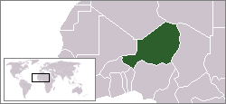
Location map for the Niger.
Originally created for English Wikipedia by Vardion.
| |
This work has been released into the public domain by its author, Vardion, at the Sowsnek Wikipedya project. This applies worldwide. In case this is not legally possible: |

|
File:LocationNiger.svg is a vector version of this file. It should be used in place of this PNG file when not inferior.
File:LocationNiger.png → File:LocationNiger.svg
For more information, see Help:SVG. |
 |
Istori an restren
Klyckyewgh war dhedhyans/eur rag gweles an folen dell o an termyn na.
| Dedhyans/Eur | Skeusennik | Mynsow | Devnydhyer | Kampol | |
|---|---|---|---|---|---|
| a-lemmyn | 22:28, 30 Est 2011 | | 250 × 115 (7 KB) | Hoshie | added South Sudan |
| 14:16, 4 Kevardhu 2007 |  | 250 × 115 (6 KB) | Gandal el gris | Sahara is not Morocco | |
| 14:15, 4 Kevardhu 2007 |  | 250 × 115 (5 KB) | Gandal el gris | Reverted to version as of 11:29, 4 December 2007 | |
| 14:14, 4 Kevardhu 2007 |  | 250 × 115 (6 KB) | Gandal el gris | Reverted to version as of 07:02, 19 November 2007 | |
| 11:29, 4 Kevardhu 2007 |  | 250 × 115 (5 KB) | Tetouancity | Reverted to version as of 11:58, 15 November 2007 | |
| 07:02, 19 Du 2007 |  | 250 × 115 (6 KB) | Gandal el gris | ||
| 11:58, 15 Du 2007 |  | 250 × 115 (5 KB) | Vispec | ||
| 22:09, 12 Kevardhu 2004 |  | 250 × 115 (6 KB) | EugeneZelenko | Location map for the Niger.<br/>Originally created for English Wikipedia by Vardion.<br/>{{PD}}<br/>Category:Country locator maps |
Devnydh an restren
Yma an folen a syw owth usya an restren ma:
Devnydh ollvysel an restren
Yma an wikis erel a syw ow tevnydhya an restren ma:
- Devnydh war arc.wikipedia.org
- Devnydh war ar.wikipedia.org
- Devnydh war bg.wikipedia.org
- Devnydh war bm.wikipedia.org
- Devnydh war bpy.wikipedia.org
- Devnydh war bs.wikipedia.org
- Devnydh war ca.wikinews.org
- Devnydh war ceb.wikipedia.org
- Devnydh war de.wikipedia.org
- Devnydh war de.wikinews.org
- Devnydh war de.wikivoyage.org
- Devnydh war de.wiktionary.org
- Devnydh war en.wikipedia.org
- Devnydh war en.wikivoyage.org
- Devnydh war en.wiktionary.org
- Devnydh war eo.wikipedia.org
- Devnydh war es.wikipedia.org
- Devnydh war frp.wikipedia.org
- Devnydh war fr.wikipedia.org
- Devnydh war he.wikivoyage.org
- Devnydh war hif.wikipedia.org
- Devnydh war hr.wiktionary.org
- Devnydh war ig.wikipedia.org
- Devnydh war incubator.wikimedia.org
Gweles devnydh ollvysel moy a'n restren ma.