Restren:New Forest National Park UK location map.svg

Size of this PNG preview of this SVG file: 608 × 600 piksel. Klerderyow erel: 243 × 240 piksel | 487 × 480 piksel | 779 × 768 piksel | 1,038 × 1,024 piksel | 2,076 × 2,048 piksel | 1,244 × 1,227 piksel.
Restren wreydhek (Restren SVG, 1,244 × 1,227 piksel yn hanow, myns an restren: 1.18 MB)
| Restren dhyworth Wikimedia Commons yw hebma. Yma diskwedhys a-woles derivadow dhyworth y folen deskrifans ena. | Mos dhe folen an restren war Wikimedia Commons |
| Deskrifans |
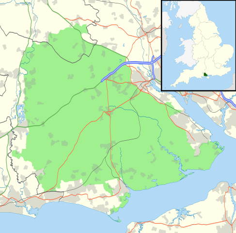
Map of the New Forest National Park, UK with the following information shown:
Equirectangular map projection on WGS 84 datum, with N/S stretched 155% Geographic limits:
|
| Dedhyans | |
| Pennfenten |
Office of National Statistics Geography
|
| Awtour | Nilfanion, created using Ordnance Survey data |
| Kummyas (Dastevnydhya an restren ma) |
Yma an restren ma yn-dann an leshyans Creative Commons Attribution-Share Alike 3.0 Unported. Askrifans: Contains Ordnance Survey data © Crown copyright and database right
|
Istori an restren
Klyckyewgh war dhedhyans/eur rag gweles an folen dell o an termyn na.
| Dedhyans/Eur | Skeusennik | Mynsow | Devnydhyer | Kampol | |
|---|---|---|---|---|---|
| a-lemmyn | 21:33, 29 Hedra 2010 | | 1,244 × 1,227 (1.18 MB) | Nilfanion | {{Information |Description=Map of the New Forest National Park, UK with the following information shown: *National Park boundary *Administrative borders *Coastline, lakes and rivers *Roads and railways *Urban areas Equirectangular map pr |
Devnydh an restren
Nyns eus folen vyth owth usya an restren ma.
Devnydh ollvysel an restren
Yma an wikis erel a syw ow tevnydhya an restren ma:
- Devnydh war en.wikipedia.org
- Devnydh war it.wikipedia.org