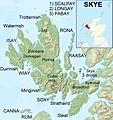
Restren:Isle of Skye UK relief location map labels.jpg

Myns an ragwel ma: 562 × 599 piksel. Klerderyow erel: 225 × 240 piksel | 450 × 480 piksel | 720 × 768 piksel | 960 × 1,024 piksel | 2,004 × 2,137 piksel.
Restren wreydhek (2,004 × 2,137 piksel, myns an restren: 867 KB, eghen MIME: image/jpeg)
Istori an restren
Klyckyewgh war dhedhyans/eur rag gweles an folen dell o an termyn na.
| Dedhyans/Eur | Skeusennik | Mynsow | Devnydhyer | Kampol | |
|---|---|---|---|---|---|
| a-lemmyn | 20:58, 13 Genver 2013 |  | 2,004 × 2,137 (867 KB) | Ruhrfisch | Remove word "MAP", all other info is the same |
| 04:21, 13 Genver 2013 |  | 2,004 × 2,137 (885 KB) | Ruhrfisch | {{Information |Description=Relief map of the Isle of Skye, UK. Equirectangular map projection on WGS 84 datum, with N/S stretched 180% Geographic limits: *West: 6.85W *East: 5.5W *North: 57.8N *South: 57.0N |Source=[[w:Ordnance Sur... |
Devnydh an restren
Yma an folen a syw owth usya an restren ma:
Devnydh ollvysel an restren
Yma an wikis erel a syw ow tevnydhya an restren ma:
- Devnydh war ar.wikipedia.org
- Devnydh war arz.wikipedia.org
- Devnydh war ast.wikipedia.org
- Devnydh war bg.wikipedia.org
- Devnydh war br.wikipedia.org
- Devnydh war ca.wikipedia.org
- Devnydh war ceb.wikipedia.org
- Devnydh war da.wikipedia.org
- Devnydh war de.wikipedia.org
- Devnydh war el.wikipedia.org
- Devnydh war en.wikipedia.org
- Devnydh war eo.wikipedia.org
- Devnydh war es.wikipedia.org
- Devnydh war eu.wikipedia.org
- Devnydh war fi.wikipedia.org
- Devnydh war fr.wikipedia.org
Gweles devnydh ollvysel moy a'n restren ma.


